


I was late getting started this morning because of updating the blog, but finally rolled out of the motel parking lot around 930. My expectations aren't high concerning seeing people I met on the walk. For whatever reason, it seems I met fewer in AZ than any other state. I took I-10 to east of Phoenix, then switched to Hwy60, which is part of the walk. Superstition Mountain rises east of Mesa, and has lots of history, plus is a popular recreation area. The Lost Dutchman's Gold Mine is supposed to be located in these mountains.
One person I did want to visit was Dianna, manager of the Arizonian RV park in Apache Junction. During the walk(day 29), Dianna allowed me to camp in the park, and use the laundry and other facilities. Her trailer was no longer where I remembered, so I asked around and finally found her in the park office. Introduced myself, she remembered me, so we had a nice talk about the walk and what's been happening in our lives since we first met. I asked her to sign the blog book, left behind a jar of Ann's Apple Butter as a token of my appreciation for her kindness. Dianna had to get back to work, and I had to get started east, so we said our goodbyes, and I headed out.
About 10 miles west of Superior, AZ, I spotted two bikers resting alongside the road. I stopped and walked back to learn more about them. They introduced themselves as Hans & Francine van Schyndel, from the Netherlands. They are cycling across the US, west to east, from Oregon to Miami. They both retired at age 50, and have been cycling all over the world since then.....11 years. Hans told me they had cycled the equivalent of 2 times around the globe. Of course I told them about my walk, and we compared the differences between cycling and walking. They average around 40-50 miles a day, although they could do more if needed. They normally sleep in tents, but occasionally will sleep in a motel or private home. They were very complimentary of Americans, and said most were kind and generous.
They don't blog, but keep lots of notes about their journey. Hans said S. Africa was one of their favorite places to cycle. I warned them about the steep climb and narrow tunnel beyond Superior, wished them well, and headed out. Before long I was in Superior, and drove through the tunnel. It is really scary, narrow lanes and no shoulders. I hope they're careful. After Superior is a series of small communities: Top of the World, Show Low, Miami, and Globe. Then through the San Carlos Apache Reservation, with communities of Peridot, Bylas, and Geronimo. I stopped and took a few pictures, but mostly kept going.
The last town in Arizona on the walking route is Duncan, then into New Mexico and on to Lordsburg. I decide to eat (a late) lunch at Kranberry's Family restaurant which is close to I-10. It's a great place, and I ate there during the walk. It was getting late and not too long before dark, so I decided to drive as far as Deming and stop there for the night. Along the way I crossed the Continental Divide at an altitude of 4500+'. The landscape through this part of NM is very flat with no trees, and mountains rising up in the distance. The sun was setting low in the western sky, casting an orange glow over the landscape......it was so beautiful. I saw a sign advertising 700 acres for sale, maybe I'll open an RV park.
One person I am going to try to find is Ivan Thompson. I met Ivan during the walk, and would like to visit with him again. At the time of my walk, Ivan had given up on his matchmaking (too dangerous in Mexico), and was working on a horse ranch east of Deming. I remember about where we met, so am going out tomorrow and ask around and see if he's still in the area. After that will head to Las Cruces, then on toward Alamogordo and points east. The next several days should be fun and interesting.
Pictures:
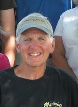
Dianna, manager of the Arizonian RV Park;
Hans and Francine vol Schyndel, from Zaltbommel, The Netherlands;
Entering Superior, AZ.....notice the town in the background, backed up right against the mountains;
One of the canyons above Superior, with a creek running through it;
A small gravesite in the Apache reservation.
Note: the pictures are larger than before, and if you click on them, will get even larger. Just learned this......
No comments:
Post a Comment